Connexion
NASA shows Crimea as Russian on a map during its eclipse broadcast
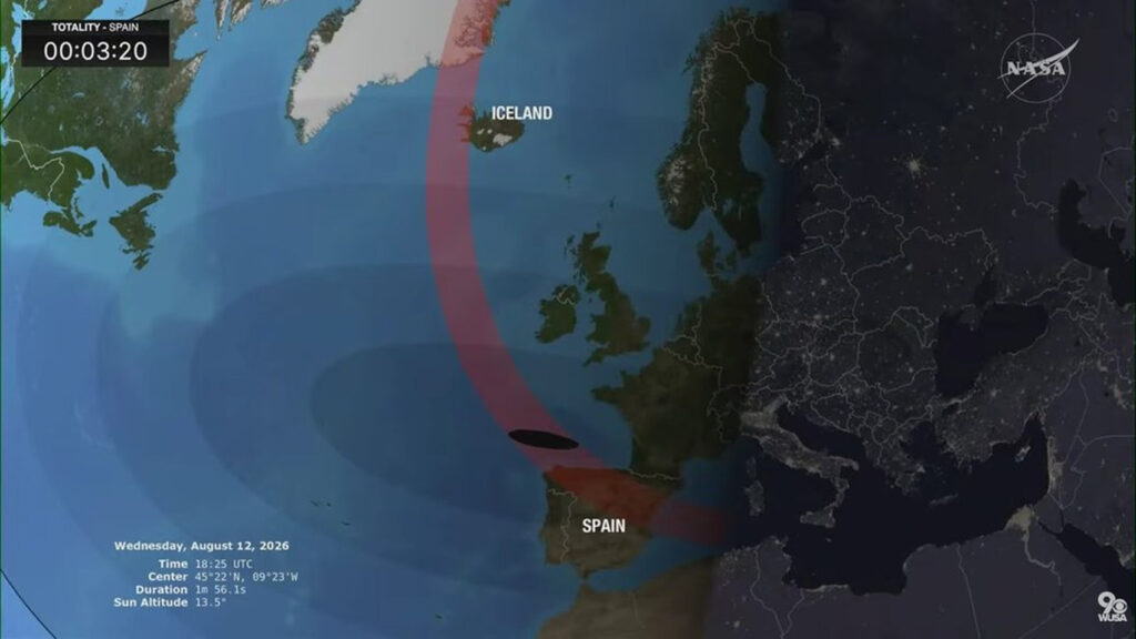
On the evening of 12 August 2026, NASA displayed a map on which Crimea was marked as Russian. It happened during the live broadcast of a total solar eclipse: on the graphic, the peninsula was separated from mainland Ukraine by a border line and presented as part of Russia.
Crimea is a Ukrainian region that Russia occupied after its illegal annexation in 2014. Ukraine and the overwhelming majority of the world's states do not recognize that annexation, and no cartographic error changes the peninsula's status under international law. Each uncorrected map treats as ordinary what international law still calls an illegal occupation.
What happened during the broadcast
The US agency streamed the total eclipse, whose path crossed Greenland, Iceland, and Spain, live to a global audience. The error appeared on one of the visibility maps NASA showed during the broadcast: on it, Russia's border was drawn along the land boundary between mainland Ukraine and the peninsula, creating the impression that Crimea belongs to Russia.
Additional images from the August 12 Solar Eclipse are on our Flickr feed. Check them out! A few more frames may be added later too.
— NASA HQ PHOTO (@nasahqphoto) August 12, 2026https://t.co/CwbEoWw3Eq pic.twitter.com/mZRukcYnZd
Not the only case
In December 2024, FIFA eventually apologized for a map it displayed during the qualifying draw for the 2026 World Cup that left occupied Crimea outside Ukraine's borders. The graphic was meant to show pairs of teams that cannot be drawn against each other for geopolitical reasons, among them Spain and Gibraltar, Kosovo and Serbia, and Ukraine and Belarus. It marked out Ukraine but drew the country without the peninsula. Ukraine's Foreign Ministry spokesman Heorhii Tykhyi objected, Kyiv called the omission an unacceptable error, and football's world governing body pulled the image.
On 24 September 2024, the British broadcaster Sky News published an investigation into a scheme for supplying sanctioned goods to Russia through third countries, Georgia among them. The report was accompanied by three maps of vehicle-transport routes into Russia, on each of which Crimea was marked as Russian territory, Detector Media reports. The maps have since been edited, and Crimea is now marked as part of Ukraine.
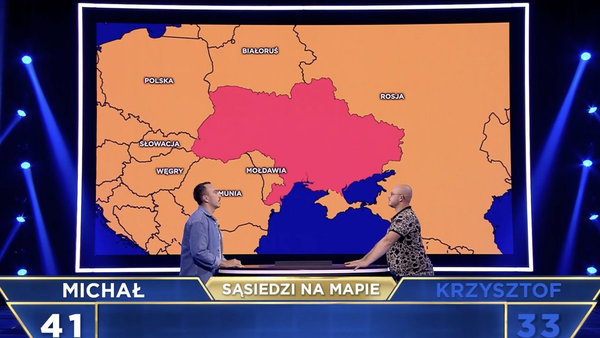
The Polish broadcaster TVN showed a map of Ukraine on which occupied Crimea was marked in a separate color during the entertainment show The Floor. The episode aired on Polish television, and the broadcaster published its video on its website in 2025.
Behind Putin's sacred Crimea stood Sevastopol's airfields
Explaining the annexation, Putin spoke not of the military but of sacred things. In his December 2014 address to the Federal Assembly, he called Crimea a place of "enormous civilizational and sacral significance," comparing the peninsula to the Temple Mount in Jerusalem. Europe rejected that mythology: just ten days after the sham referendum, the UN General Assembly passed Resolution 68/262 by a vote of 100 to 11 and declared the annexation illegal.

But behind Moscow's "spiritual" rhetoric lay a different purpose for Crimea. Sevastopol, its airfields, and its logistics turned the peninsula into a springboard for the 2022 invasion, and it is largely for this reason that Ukraine's forces are now focused on striking Crimea. Robert "Madyar" Brovdi, commander of the Unmanned Systems Forces on 10 August said that the strikes are the first phase of a campaign meant to render the peninsula unusable for Russian troops.
"Crimea is one of the key conceptual pillars on the path to ending the war," Madyar told the Associated Press.
Read also
-
First warehouses burned, now payment system is down: Ukraine launches dual campaign against Russia’s largest marketplace that reportedly moves drone parts
-
Reported Flamingo strike hits Samara industrial area housing factory that builds rockets for Russia’s Starlink rival
-
More than 100 drones detected near Romania in four days, NATO jets scrambled seven times